
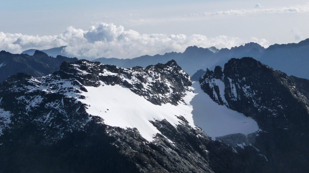
Mount Speke
Mount Speke is the second-highest summit in the Rwenzori range, situated within Rwenzori Mountains National Park. Mount Speke, Mount Baker, and Mount Stanley form a triangular configuration that encompasses the upper Bujuku Valley. Mount Speke is situated 3.55 kilometers (2.21 miles) to the south-southwest. The mountains are situated in a region referred to as The Mountains of the Moon. Every mountain in this range possesses multiple jagged summits. The summits of Mount Speke comprise Vittorio Emanuele (4,890 meters), Ensonga (4,865 meters), Johnston (4,834 meters), and Trident (4,572 meters).
Although the names originated from an Italian royal lineage, they required acceptance by the administration of the British Protectorate of Uganda, which governed the area at that time. Upon the initial arrival of European explorers in the region, seeking the origin of the mighty Nile, this peak was designated in honor of John Speke. In 1862, Speke delineated the origin of the White Nile, although never ascending this peak. All mountains in this region are named after interrelated explorers who came in Africa during the initial phase of colonialism. Mount Speke is traversed by numerous streams and rivers due to the substantial rainfall it experiences, and its vegetation appears lush.
Day 1: Mihunga Gate (1651 meters above sea level) – Nyabitaba Camp (2651 meters above sea level)
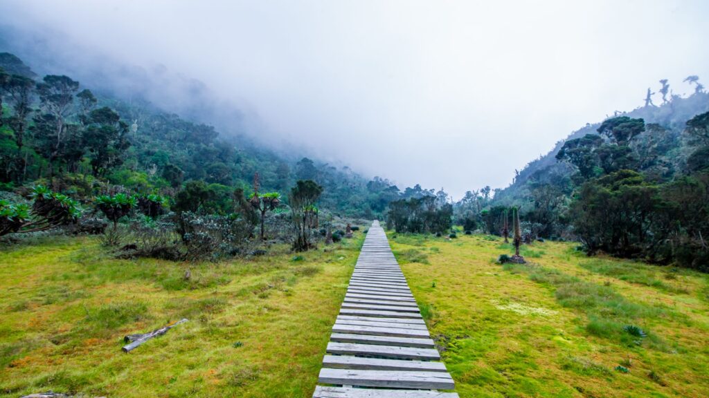
The hiking expedition to the summit of Mount Speke commences at the park entrance in Mihunga and proceeds via the Central Circuit Trail. Upon approaching the park gate at the conclusion of the drive, you are welcomed with invigorating air falling from the mountain, revitalizing you for the forthcoming trek. The path commences by crossing agricultural land to reach the park perimeter. The route traverses a deep forest adjacent to the Mubuku River, passing its tributary, the Mahoma River, before commencing a prolonged, steep ascent into a substantial ridge to arrive at Nyabitaba camp.
This segment of the journey may feature the sounds of chimpanzees and the sight of black and white colobus monkeys, blue monkeys, and the vividly hued Rwenzori turaco.
The hike typically requires approximately 6 to 7 hours.
Day 2: Nyabitaba – John Matte Camp DAY 2 (3505 meters above sea level)
Traverse the path through the forest from Nyabitaba to the Kurt Shafer Bridge, situated directly beneath the confluence of the Mubuku and Bujuku rivers. Navigate a lengthy and arduous expanse of slippery moss-laden rock while passing through the bamboo grove. Mount Stanley and Speke are seen from the Nyamuleju rock shelter prior to entering the region of colossal heather, lobelia, and groundsel. Following an arduous trek through the mire, you will reach John Matte Hut. Today marks the longest day of the Central Circuit Trail. Dining and resting at the John Matte cabin.
The hike typically requires approximately 7 to 8 hours.
Day 3: John Matte – Bujuku Camp – Day 3 (3962 meters above sea level)
The path descends from John Matte Hut to cross the Bujuku River and enters the Lower Bigo Bog, which features large lobelias. The bog is ultimately traversed by jumping from tussock to tussock. The upper Bigo bog invariably culminates at Bujuku Lake, offering vistas of Mount Baker and Mount Stanley to the south and west. Bujuku Hut is situated in a gully beneath Stuhlmann’s Pass, in the vicinity of Mt Baker and Mount Speke. This camp is optimal for acclimatization for tourists intending to ascend Mt. Stanley and Mt. Speke. Bujuku hut for dinner and overnight accommodations.
The hike typically requires approximately 4 to 5 hours.
Day 4: Bujuku – Mt. Speke (4890 m asl) – Bujuku – John Maate
Commence the ascent to Vitorio Emanuele peak early in the morning via Stuhlmann’s Pass (4192m asl.), enjoying the stunning vistas of Virunga National Park in the Democratic Republic of the Congo. The ascent to the peak requires 4 to 5 hours. Commence the descent from Vittorio Emanuele to Bujuku Camp, featuring vistas of the Bujuku Valley and Lake, as well as the Margherita and Albert Peaks on Mount Stanley, and Mount Baker. Proceed to Bujuku and continue to John Maate Camp for an overnight stay.
The descent typically requires between 3 and 4 hours.
Day 5: John Maate – Nyabitaba – Nyakalengija Day 5 at an elevation of 1615 meters above sea level.
The path crosses the Kichuchu cliffs beneath Guy Yeoman. The muddy path beyond Kichuchu traverses River Mubuku twice through a bamboo forest before ascending to Nyabitaba to complete the round. Proceed with the descent to Nyabitaba Camp and conclude your journey by evening at Mihunga Gate, where you will overnight at your hotel in Kasese. The descent requires approximately 7 to 8 hours.